YOUR BUSINESS AUTHORITY
Springfield, MO
YOUR BUSINESS AUTHORITY
Springfield, MO

Mercy Springfield Communities signaled an interest in expanding at the Dec. 12 Springfield City Council meeting.
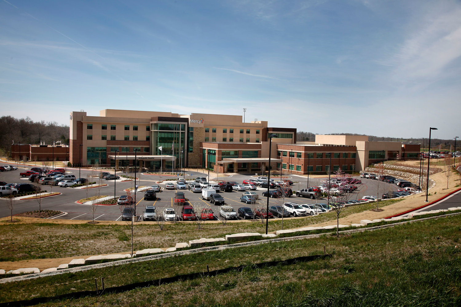
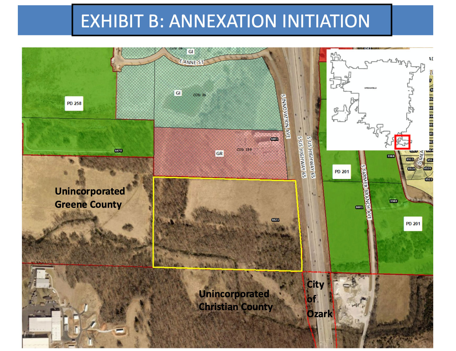
Council passed a resolution declaring the city’s intention of annexing into the city 27 acres of property located at 6621 S. Innovation Ave. The parcel of land is located just south of Mercy Orthopedic Hospital Springfield along U.S. Highway 65.
Springfield Planning and Development Director Susan Istenes said via email that Mercy is under contract to purchase the property, but its acquisition is contingent upon approval of the property’s annexation and rezoning.
Sonya Kullmann, Mercy’s media relations and communications manager, had few specifics to offer about the health system’s plans, and despite the council action, she cautioned that Mercy is not yet ready to close on the purchase.
She noted, however, that addressing community need is part of Mercy’s history.
“We’re doing just what the Sisters of Mercy did in 1891 when they opened the first hospital in the area,” she said in an email. “We’re growing to meet the needs of our neighbors.”
More population in that area means more need for services, according to Kullmann.
“There are no definitive plans for that parcel now, but the area continues to grow with more homes and businesses,” she said. “As needs change, Mercy wants to be able to bring more services close to home for people in that area.”
Mercy Springfield’s main campus occupies 76 acres south of Sunshine Street and east of National Avenue near the center of the city, according to Greene County assessor data.
The resolution approved Monday only initiates the proposed annexation and paves way for the property purchase. Council also will be asked to rezone the 27-acre plot to a government and institutional use district from its Greene County zoning designation as an agriculture district.
Hearings on separate resolutions for annexation and rezoning are scheduled for the Jan. 9 council meeting, with votes to follow on Jan. 23.
The parcel of land abuts a small, outlying tract of city land located south of James River Freeway.
The city’s map is irregular in the area of the proposed development, with Highway 65 leading to what is known as a flagpole annexation – an area connected to the city by only a slender strip of land at the time of annexation.
Springfield’s newly adopted comprehensive plan, Forward SGF, aims, in part, to pursue annexation of areas that have high strategic or economic value, according to past Springfield Business Journal reporting.
The guiding principle for annexation is for the land that is added to be compact and contiguous, with city officials recognizing that flagpole annexation is undesirable.
Current property owners are listed in the city’s explanation of the council bill as Kenneth L. and Helen Stoddard et al. Corey Weimer of Olsson Inc. was listed as representative of the owners.


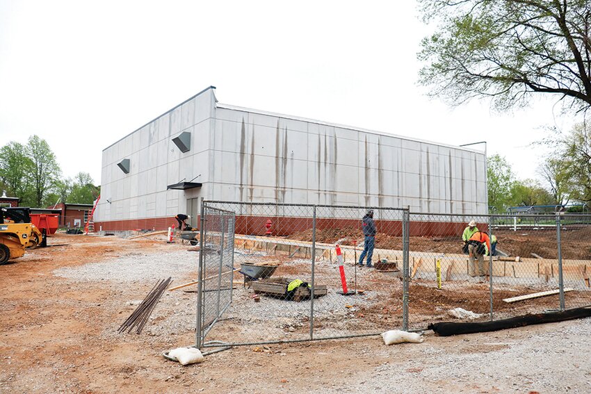
Connected to Watkins Elementary School is a new storm shelter now under construction.
STL construction firm buys KC company
Updated: Systematic Savings Bank to be acquired in $14M deal
Missouri House speaker accused of obstruction in ethics probe
Webster University's deficit triples
‘Dress for your day’: Companies are relaxing dress codes amid evolving ideas about fashion